Pages

Monday, February 28, 2022

Red Rock Canyon State Park


 “Who is that idiot with the helicopter swirling up all the dust, burying my velociraptor?” asked Dr. Grant (actor Sam Neill), as he was surrounded in great clouds of fine silty desert sand.

Dr. Ellie Sattler (actress Laura Dern) responded, “I don’t know, but he is causing quite a problem.”

A huge white helicopter dropped to earth and the rotors slowly ebbed. A grey bearded, white suited older gentleman walked from the craft. “I am John Hammond (actor Richard Attenborough), a ridiculously rich person who has enough money to offer the both of you one gazillion dollars each to do me a little favor.”

“And that favor would be?” Dr. Sattler asked.

“To bring back to life the most dangerous and lethal creatures the earth has ever seen,” Hammond responded.

Grant nodded his head. “What could go wrong with that? Count us in.”

And the rest is history, with the multi-trillion-dollar success of the Jurassic Park film series. 

What could go wrong?

Nothing wrong at all, except for dinosaurs who had not seen the light of day for sixty-five million years suddenly wreaking havoc on humankind.

Spoiler alert, the film should have been called Cretaceous Park, since both the velociraptor and T-rex lived during that period and not the Jurassic era, but why quibble?

Steven Spielberg knew that would not work. Cretaceous Park does not roll off the tongue as does Jurassic Park. In fact, the term Cretaceous sounds as if a person should be seeing a podiatrist about some sort of toe fungus.

And what does all this have to do about traveling? Not much, but as I was examining the flaws in the movie, I suddenly wondered where it was filmed.

Now, I have been to Oahu where big galloping dinosaurs nearly ran over Grant and the kids he was trying to protect in Kualoa Ranch, (I meant the hinterlands of Isla Nublar), but I suspected that some of it was filmed right here in our backyard of Southern California.

Kualoa Ranch, Hawaii
Turns out the opening scene when Hammond meets Grant and Sattler was filmed in the Red Rock Canyon State Park. A mere hundred miles northeast of Los Angeles and one thousand three hundred miles from British Columbia, Canada.

“A trip is called for,” I shared with Laureen.

My loving wife would never turn down a trip of such importance, but she surprised me. “I would love to go, but I made another commitment.”

The commitment was granddaughter sitting for our precious little Jasmine. I was on my own – of course, I love spending time with my beautiful granddaughter, but my editor can be like the soup guy from the nineties sit-com Seinfeld.

“No story - no pay for you!”

Those bosses, sometimes!

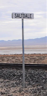
I headed out on Highway 14, toward Red Rock Canyon State Park. 

I hate to admit it, but I have never experienced this state park. In fact, there are a lot of national and state parks I have yet to experience. Shame on me – but there are only five hundred days in a year, and the time flies when you are not paying attention.

Per the California Department of Parks and Recreation website, this is a must go place to visit.

‘Red Rock Canyon State Park features scenic desert cliffs, buttes and spectacular rock formations. The park is located where the southernmost tip of the Sierra Nevadas converge with the El Paso Range. Each tributary canyon is unique, with dramatic shapes and vivid colors.’

That sounded impressive. I had never even heard of the El Paso Range, believing it was in Texas, and here I was about to see it up close and personal.

This range lies in a southwest-northeasterly direction, east of Highway 14. That sounded rather confusing, so I just drove north on Highway 14 from Highway 58 and hoped I would run into the eighteen-mile-long mountain range.

Red Rock Canyon State Park is only sixteen miles northeast of California City, so I figured if I got lost, I could double back and ask for directions. Yes, I sometimes do that – but Laureen does not know this secret.

This whole section of the Mojave Desert was once home to various Native American tribes, dating back as early as three thousand years ago. In fact, the Kawaiisu are believed to be direct ancestors of these peoples and have lived in the area for possibly fifteen hundred years.

It is theorized that many native peoples lived in the Sierra Nevadas, but when a mini-ice age struck the area approximately three thousand years ago, they moved to the warmer climate of the Mojave Desert, where their ancestors made their permanent home.

My trip was looking like it was going to be very interesting. In fact, there are petroglyphs, created by the Kawaiisu in the El Paso Range, showing in graphic detail what life was like for these people.

In 1776, missionary Francisco Tomas Garces, met with a group of Kawaiisu while traveling through this part of the Mojave Desert. The natives found the Garces team rather worn out and hungry, and so they gave the explorers baskets full of meat and seeds.

Pretty considerate folks, those Kawaiisu.

In 1853, the United States government relocated the Kawaiisu from the area, since they were ‘impeding’ settler development in the area. Relations between the natives and the government soured at that point.

Who could have figured that would have occurred? Not very considerate, those government officials.

Both the El Paso Range and Southern Sierra Nevada’s were used by folks moving west from the east. The colorful cliffs and buttes surrounding, what would be later identified as Red Rock Canyon, became a guide for those making their way across the Mojave Desert.

I drove north on Highway 14 and came upon a road sign stating I was now entering the Red Rock Canyon State Park. I was not impressed.

Of course, enjoying a drive through the Mojave Desert is what I truly love doing, but I thought all the hoopla I had researched about the area would have been a little more enthralling. 

Driving on a couple of miles north changed my mind.

“Holy Moley,” I said, and pulled over to the side of the road.


In the near distance stood some of the most majestic, beautiful, and weird looking landscapes I have ever seen.

Tall red, white, and sand-colored buttes seemed to be thrusting out of the desert floor, as if escaping the bowels of the earth. Columns upon columns, intersecting each other gave a vision as if from another planet. These are not the common hills a person sees while driving through the Mojave Desert. No, the scenery was awesome. 

In fact, Hollywood had figured this out decades ago, with the filming of Battlestar Galactica, Andromeda Strain, Capricorn One, Planet of the Apes, and other movies or television series set on alien worlds.

Of course, Hollywood also used the canyons as filming sites for Westworld, The High Chaparral, Laramie, and many other westerns. 

I drove on toward the buttes on the east side of Highway 14, even though both the east and west buttes were towering above the black highway – as if the hills had purposefully created an avenue for gawking visitors.

There is a large visitor parking lot at the base of an extremely impressive butte.

 I parked and was astonished at how many people had done the same thing, with families, couples, and folks on horseback taking advantage of such an awesome natural formation.

Geologists explain how these structures were constructed: ‘Red Rock Canyon began about 300 million years ago when sand and gravel washed down from the ancestral Rocky Mountains to form alluvial deposits which became the Fountain sandstone on the edge of the present location on Manitou Springs. Fifty million years later, shifting dunes of fine sand drifted into the area to become the red Lyons sandstone of Red Rock Canyon itself.’

The geological explanation goes on for another thousand paragraphs but suffice to say – it took a long time and a bunch of different natural events to converge and create what I happened to be staring at.

However these buttes were formed, they were impressive and truly demonstrated the power and patience of nature. Three hundred million years – heck, my patience runs out if I must wait five minutes for my latte at Starbucks.

There are hiking trails in and around the buttes and are a must when visiting. To get up close and take in the view of the tall towers allows a person to feel overwhelmed with how beautiful nature can be.

It was if I were peeking up through tall chimneys into the sky above walking from one edge of a butte to the other.

A chimney view at Red Rock Canyon State Park
The whole experience was other-worldly, and I expected a cryptid or an alien to look out from one the thousands of caves, and tell me to get lost.

Camping is allowed in the Ricardo Campground – not named after Ricky Ricardo, but an old timer who sold goods to miners seeking to find their riches in the area in the late nineteenth century, as well as a visitor center.

A couple of the camp sites at Red Rock Canyon State Park

It is a perfect location for any sort of filming, and a place worth visiting time and again. 


For further information:   https://www.parks.ca.gov/?page_id=631          


Monday, February 14, 2022

Saltdale - gone but not forgotten

 A sense of foreboding overtook me as I gazed across the miles of salt flats. I am not one to have those feelings, but there was something here, as I walked out onto the mushy lakebed that unnerved me.

As if on cue, my right boot sunk into the whitish muck nearly to my ankle. Then, just as suddenly, my other boot sunk knee high into the goo.

Normally, that wouldn’t bother me, except I was still inside those boots. Suddenly, I had images of Lot’s wife, and I too would turn into a pillar of salt.

How would Laureen accept the news that her adventurous husband had somehow got himself buried in a thousand feet of wet mushy salt all alone? 

Not being able to think of an appropriate answer, I carefully and with humility, backtracked to a drier piece of earth – still wearing the boots. They had not been sucked off me, like they once had been at Mono Lake – but that tale is for another time.

I found myself at the ghost town of Saltdale, twelve miles northeast of California City, along the Redrock Randsburg Road, and ghostly it was.

Saltdale rail siding

There is nothing left but a few housing slabs, blocks of cement, abandoned railroad tracks stretching across and into Koehn Lake, and the feeling that this place once was inhabited by family and friends.

Remnants of a house

I enjoy traveling. But sometimes, when exploring communities that no longer exist, there are questions about the place that come to mind along with the understanding there will be no satisfactory answers coming.

What happened to the people? Where did they go? Did they give-up on their dreams of success and just move away? Did they find happiness again, eventually?

Perhaps it was being mired in the endorheic lake for a few moments, which allowed my mind to wander rather pointedly toward the population that once resided beside this large empty lake.

Koehn Lake is also referred to as a sink lake or terminal lake. Simply put, it is a body of water with nowhere for the water to exit. There are no streams or rivers that run from it or to it. Thus, the water evaporates, often leaving behind large deposits of saline. Which in the case of Koehn Lake, was a money-making opportunity for those wishing an almost endless supply of salt within the Fremont Valley.

Dry Koehn Lake

The Mohave Desert has lots of ghost towns, and Saltdale happens to one of many – but it wasn’t always so.

In 1914, mining of the salt located in Koehn Lake, named after Charles Koehn, began by the Consolidated Salt Company. 

It turns out, there is a very interesting tale of claim jumping, gun play, and general shenanigans when it came to all the mining that was to go around this lake of salt at the time and the following decades to come. The whole drama is better suited for a Netflix series, then here in this column, since it gets rather complicated on who did this and who did that. I’d be tired by the time it was all written in chronological order.

Like being stuck in mud, being tired is not fun.

In 1913, the Consolidated Salt Company was formed, and in 1914 a crushing and screening plant was built, along with a small-gauge railroad track out into the dry lakebed. The mining results were amazing, with nearly two hundred and fifty tons of salt shipped out weekly by railroad cars. By the end of 1914, the total production was over twenty-thousand tons of processed salt.

Salt was very popular it seems, and still is.

“Do you want salt on your French fries,” a waitress may ask.

“And who doesn’t?” would be the response from an imaginary customer.

The production ran so high, that by 1915, the company was producing seven hundred and twenty tons a week and employed sixty-five workers to keep up with demand.

A post office opened in September of 1916 and the town of Saltdale was on its way to becoming mining boomtown.

But the Southern Pacific railroad could not supply enough cars to carry the salt. And that, is where the troubles first started. Because of the lack of cars, there was a delay in shipments up to five months. 

This is what modern economists would refer to as a supply chain issue, and no one wanted to wait five months to salt their fries.

Then, like in many melodramas, ‘fake’ claims were discovered and filed in court over the right to mine salt. 

Research showed more than a billion claims were filed over a few years and the production of the salt in the lake was divvied up between competing companies.

Between all the salt companies around the lake, over seventeen thousand tons of salt was processed in 1919.

In the same year, electric power was supplied to the mills and town by the Southern Sierras Power Company. The modern era had arrived.

More and more folks moved into the area and in 1920, the Saltdale School District was formed but very few students were enrolled. The students who did go to school, attended classes in the company’s office buildings in the beginning.  

So, no official schoolhouse was built at the time. 

“No, schoolhouse rocks for you!” the Superintendent may have yelled.

Production continued for years, but sometimes the rains did not, and the lake could no longer fill and evaporate leaving the salt deposits behind. The various salt companies would pump water into specific locations in Koehn Lake to induce the evaporation of the water but that was expensive and time consuming.

By 1924, only six men still worked at the Consolidated Salt Company.

And like many future ghost towns, Saltdale had its up and downs. Good wet seasons producing a bountiful of salt, and leaner drier years where production was minimal.

In the mid-twenties, a post office, gas station, grocery store, and a school were constructed along the Cantil-Randsburg Road.

There were local dances, picnics, dinners, and the more festivities making this a very friendly and safe community to reside in.

During the Great Depression, the town hung on but in the 1940s, gypsum was found in increasing amounts in the salt fields. This reduced the amount of pure salt being able to be processed and shipped out, thus continuing to reduce the number of workers at the various mills around the lake.

With the gypsum influx, and a few years of very low precipitation, Saltdale was on its way of becoming a ghost town. 

The post office closed in June 1950 and the school district formally dissolved the following year.

One mill owned by the Long Beach Salt Company, was able to keep operations going through these tough times, but none of the four workers lived in Saltdale. In 1975, the United States Interior Board of Land Appeals decided all mining claims on Koehn Lake were null and void.

It was the final death knell for a town named Saltdale.

Standing beside the abandoned railroad tracks reaching out into Koehn Lake, made me imagine what it must have been like to work and live in this remote area of the Mojave Desert. Sure, a small town with family and friends, but the nearest hospital or emergency services were in Randsburg sixteen miles away over a rough dirt road.

Tracks to nowhere

There is not much left to show where the school, post office, or other buildings were in Saltdale. The weather and the corrosive powers of the salt fields soon dispatched any remnants of the town. There is a section of railroad, near where a large modern platform had been built by the Southern Pacific Railroad in the 1930s.

Not wanting to venture any further across the wet surface of the lake, I decided the usage binoculars and a drone were the only safe ways to get a deeper look into the surroundings. I did not want to take another chance of losing my boots or worse to the brine awaiting me if I left the comfort of a solid footing.

Perhaps another season would encase the ground into a hard packed surface, but since it had rained recently – these were the best possibilities to learn more of what happened to this once thriving community.

A rusting tin roof of a building two hundred yards offshore peaked out from the salt surrounding it. It was as though the structure itself had died and was slowly crumbling out of sight. 

A sinking structure in the distance

A wooden set of railroad ties, being eaten away by the environment crisscrossed along the lakebed. The rails long gone, but the proof of a busy time from the past was evident.

Clouds covered the skies and a new chance for rain looked imminent. It was time to call this adventure done.

As I made my way back over the dirt roads to the pavement, my thoughts once again ran back to when this town was alive and vibrant.

Perhaps that is why I visit such places. To remember.