Pages

Showing posts with label Barstow. Show all posts

Sunday, March 17, 2024

The Not so Ghost Town of Ransburg

Welcome to Randsburg, CA
Standing midway down Butte Ave, I believed I was in a new filming for the hundredth Mad Max series.
Run for your lives - nope, everything is safe
Dozens of RZRs, dune-buggies, dirt bikes, off road golf carts, and gyrocopters came screaming out of the northwest through this tiny burg.

Folks dressed head to toe in leathers, cottons, tree bark, and stretched out leggings barreling through this living ghost town one mile south of Highway 395 made a person pause.

There were mullets on helmets. Sideburns on helmets. Mohawks on helmets, and helmets on helmets.

It was surreal, but I did not stand in the middle of the road for long, not wanting to end up as roadkill, which was being served for lunch I was told at the local park. 

“It’s really good if it is fresh, with not too many tread marks,” a grizzled miner may have uttered.

I was in Randsburg, a supposed ghost town that seemed pretty alive.

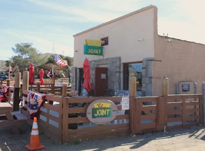
“Fall, winter, and spring are our busiest times of year,” noted Neil, the owner of The Joint. “People love camping out in the desert nearby and then rolling in here for lunch and perhaps a cold beverage.”

Sort of funny, “rolling in here” by the owner of ‘The Joint.’ Just saying.

The Joint in Randsburg
Actually, in all transparency stopping by any saloon usually makes my day. It gets mighty thirsty on the road.

Interior view of The Joint in Randsburg, CA
I had traveled through Randsburg many times on my way here and there along Highway 395. It’s a quaint locale with friendly folks, an interesting history, and clean free public restrooms in the town’s city park.

A must for a traveler.

The definition of a ghost town, according to Dictionary.com, is a town that was once thriving  that has been completely abandoned. According to Geotab.com a ghost town was once a thriving community that has dwindled over the decades. According to Oregon.gov, ghost towns are abandoned villages or cities, often with substantial visible remains.

Well, that last one could mean a whole lot of towns and cities now in California.

“You know, Neil,” I said. “You live in a ghost town according to what I’ve read.”

He just looked at me and wandered back into The Joint.

I should have stuck with the one definition I knew had to be accurate from theydon’tknowwhattheyaretalkingabout.com which stated that a ghost town is what people call places they have not traveled to.

Downtown Randsburg
Randsburg is not a ghost town. Sure, there are ghosts, according to the paranormal folks, locals, and a few miners who told me they have shared bottles of whiskey with the ghosts - okay, but it is not a ghost town in any sense of common sense.

Prior to Neil abandoning me in the street, he did state there is a ghost of a miner that sits atop the roof of The Joint. The ghost is supposedly a disgruntled ex-customer who was told eons ago that he was no longer welcome due to his bad behavior. I glanced up to ensure no wily bearded miner was lingering atop the building and dashed inside in case I may end up with a dropped pickaxe on my noggin.

No, this tiny town 68 miles northwest of Victorville and 138 miles northeast of  Los Angeles has a lot of life to it and a wonderfully interesting history.

Randsburg is known as one of the small towns within the gold and silver mining belt of Kern County.

 Randsburg, as well as Red Mountain and Johannesburg - other so-called ghost towns, that were once hustling and bustling jurisdictions where gold and silver could just be picked off the desert floor.

“Looky, Maxwell,” a dandy of a miner may have shouted after picking up a three ton solid gold nugget. “I be rich!”

That is not true. 

Community church in Randsburg, CA
Randsburg is located in the Rand Mining District, named after the Rand Mountains where it is located along with Red Mountain and Johannesburg.

According to the Los Angeles Daily News, three down-and-out miners wandered the Rand Mountains in 1895 and stumbled across a huge gold bonanza southwest of Ridgecrest - later to become Randsburg.

The miners who had been down-and-out were Frederic Mooers, John Singleton, and Charles Burcham and rumor has it that Frederic smiled at his two buddies and said, “Guess we are no longer down-and-outers.”

Where Singleton may have replied, “I can’t wait to see the face on my mother-in-law now.”

But with all history things can become a bit wonky. According to other research it was actually Frederic Mooers and William Langdon who actually found solid traces of gold in the Rand Mountains  in 1894. It was in 1895 that Singleton and Burcham were brought into the partnership, along with Dr Rose. 

Whatever be the case, the Rand Mining District was created in December of 1895 and a gold rush began. Some reports state that it was one of, if not, the largest gold rushes in California history with the Yellow Aster mine being the centerpoint of gold discovery.

Starting with just a few folks mining for riches soon turned into a boom and by 1896 more than 1,500 people were calling the area home.

Of course, where there is one mine, soon many more started opening up as more and more deposits were located. King Solomon, Jolly Girls, Monkey Wrench, Bully Boy, and Look What I Found were just some of the mines that soon opened.

By the end of 1897, folks were getting very rich working the various mines in the Rand Mining District, especially the Yellow Aster which produced more than $600,000 in gold, which is about $22,000,000 today.

Another rumor is that when Singleton’s mother-in-law heard the news, she simply said, “You call that money?”

One of the old mines located in Randsburg, CA
So much ore was coming out of the earth that it was hard to transport to various locations for processing; Garlock and Barstow. Shipping the ore over the newly built Randsburg Railways was slow due to the extent of the output, so a thirty-stamp mill was built in 1899 in Randsburg. Soon a much larger one hundred stamp mill was called for to handle all the ore being taken from the various mines in the area.

By 1901 the Yellow Aster mine was kicking out $120,000 worth of gold each month, well over four million dollars today. Silver was also being mined with huge profits from adjourning mines that covered the Rand Mountains.

Like all boom towns, it wasn’t just miners that got into action. Nope, plenty of saloons, gambling halls, and brothels showed up to ensure the miners did not walk away with all that cash in their pockets alone.

To save the souls of the now nearly 2,500 citizens of Randsburg in 1897, churches began to sprout up along the narrow and congested streets. Since some of the miners were married, as well as the shopkeepers, schools also were constructed.

It was a good time for all.

In 1898 two devastating fires erupted and nearly destroyed the entire town of Randsburg, but some quick thinking individuals used dynamite to blow up structures creating a break where the fire could not spread from block to block.

With the tough spirit of these pioneers, the town was rebuilt even better than before.

An interesting side note concerns neighboring Red Mountain, where numerous accounts state that during prohibition, folks all the way from Los Angeles would travel there during the weekends to partake in the over 30 saloons and brothels located in the area.

A tidbit here, Dr. Rose Burcham is not only considered one of the first pioneer female physicians in Southern California but in 1904, the Los Angeles Times honored her with, ‘Men of Achievement in The Great Southwest Mining’. - the only successful woman mine operator in the southwest.

A hardy and smart woman, she outlived her mining partners, dying in 1944 after retiring to the state of Alabama.

By 1934, with the depression and the ore not producing as much gold or silver as in the past, the town started to dry up. Folks moved on to the next boomtown but today Randsburg is still very much alive with shops, restaurants, saloons, and places to stay for the night.

The small town offers wonderful events throughout the year, including; Old West Day, Bluegrass Jamboree, Mohave Dirt Bike Rally, Don’t Fall Into An Empty Mineshaft Day, and so much more for the visitor. 

And if camping in the wide open desert isn’t your cup of Joe, then there are places to stay for the night in Randsburg, from the Cottage Hotel Bed and Breakfast, to numerous Airbnbs - some supposedly used as cribs utilized by the soiled doves in the day. May have to use the Old West Dictionary for that description.

Cottage Hotel, one of many places to stay at Randsburg, CA
Though I’ve traveled through Randsburg for years, I learn something new with each visit, and isn’t that the way adventures go?

Daniel, a bartender at the Joint, poured me a drink. “Are you coming back?”

I may be there already.


Friday, May 3, 2019

Calico Early Man Site


Many times during research, we come across a lot of interesting facts. Most research is pretty straight forward but this blog's research turned out to be something unexpected - a very curvy bit of history was discovered.

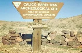
Anthropology and archaeology are high interests for both Laureen and John and one place they have visited in the past was the Calico Early Man Site which is about 15 miles northeast of the city of Barstow, near the town of Yermo, in Southern California.

The history of the Calico Early Man Site is fascinating, with big time scientific names putting the place on the map for a potential history changing event. 

When did early humans actually populate the Americas? That question was thought to be solidly answered with evidence that approximately 12,000 or so years ago the first humans ventured upon the lands later to become the United States. Of course, some anthropologists postulated that it could be as early as 30,000 years ago but all of this up to interpretation of sites found around the country.

Then along comes the premier anthropologist of his day, Louis Leakey to shake the academic world up like a can of dropped soda.


While Leakey was working in the British Museum in 1959, he had an encounter with a fellow scientist which would change his remaining years forever. The world renowned discoverer of million-year-old hominids in the Olduvai Gorge in Tanzania was suddenly looking at what appeared to be early stone tools from a place named Calico. San Bernardino archaeologist, Ruth DeEtte (Dee) Simpson had visited Leakey in London to obtain his professional judgment on what she had carried half way across the world. Was what Leakey seeing simply naturally formed geofacts or truly human made artifacts?

The British Museum - London
A geofact is a naturally occurring ‘flaking’ of a rock that can appear to be made by the human hand whereas an artifact was created by a human from the past.

The celebrity anthropologist believed that the oddly sharpened stones he was holding were truly man-made. These tools were very similar to ones he had discovered, along with his spouse, Mary, from early human dig sites from around the globe.

Geofacts or Artifacts - you judge
By 1963, Leakey had garnered the support of National Geographic Society which funded the dig site where Leakey, along with Simpson, spent considerable time from 1964 until 1970.

Simpson and Leakey at the Calico Early Man Site
What he found or believed he had found tarnished, and some in the anthropological spectrum believed ruined his credibility totally.

In 1970, Louis Leakey conducted an audio recording for the Pleistocene Coalition News. In this recording, Leakey came up with some pretty hard to swallow statements concerning objects being found in what would later be known as the Calico Early Man Site.

“I have consistently refused to say more about Calico than that it is over 50,000. And I have consistently warned the crew that it may be a great deal more than over 50. But the safe thing is to say that it is certainly over 50 – beyond the range of carbon dating.” (official transcripts from PCN).
Some of his statements concluded that the site showed evidence of human settlement of over 200,000 years.

Leakey’s idea that over 60,000 hand tools had been created at the site without the tiniest bit of human habitation evidence, besides the tools, caused skeptics to simply shake their heads. 

The basis for his theory was there were too many different languages/dialects within the native population of America to have developed within the past 12,000 to 15,000 years (typically agreed upon years by most anthropologists). He believed that many more thousands of years would be needed for the variety and different languages that were being spoken across the Americas.

If, Louis Leakey’s calculations were correct, then the Calico Early Man Site would be the oldest human location ever found in the Western Hemisphere. 

Louis Leakey was so adamant about his finds and would not stand down from them that Mary Leakey and he split up in 1968 after decades together searching the earth for any signs of past human life. Together they had made remarkable finds but this Calico obsession of her husband’s was too much for Mary.

“I ended by losing my professional respect for Louis; and it had been very great indeed,” she wrote in her autobiography after Louis’s death in 1972.

Louis and Mary Leakey in Tanzania - happier times
Of course, this brought out disbelief and worse for those in the academic world. It was called a hoax or worse, Louis Leakey’s last attempt at fame.  

But was the site a hoax or truly a discovery to match the ones Louis Leakey and his spouse, Mary had found in many of their most famous early human digs?


The Controversy begins
It is known that the area compromising Barstow, Yermo, and Daggett was once a large fresh body of water named Lake Manix. The last major glacial episode, during the Pleistocene age, approximately 2,588,000 to 11,700 years ago the area was covered with thick ice which slowly melted. Lakes such as Manix formed about 400 to 500 hundred thousand years ago.

Map of dig site(s) and where Manix Lake once covered the area
During this era, the area surrounding the large lake was lush with grass and a variety of plants allowing such animals such as camels, mammoths, saber-tooth cats, eagles, ducks, and whole plethora of other animals to exist.

The lake emptied about 18,000 years ago – probably due to tectonic movements during earthquakes along the Manix Fault, leaving behind what we now know as the Mojave Desert. With that draining and thousands of years of drying the lake bed turned into what we now recognize as the Mohave Desert. Most of the animals, except a few like coyotes and rabbits, became extinct.

In 1972, after Louis Leakey’s death, the area was taken over by the California Bureau of Land Management and soon the site was open to the public. 


The following decades the site was visited year round by the curious, the amateur anthropologist, the college student, and anyone interested in knowing the hidden history of the desert.

Unfortunately, this historical site in the Mohave Desert was closed to visitors approximately two years ago, according to Katrina Symons, Field Manager for the Bureau of Land Management at the Barstow office.


“The extent of the damage was enough that the bureau decided it had to close it,” Symons stated while discussing the vandalism and theft which occurred at the site. “Vandals tore doors off of the two cabins which are at the site along with stealing various items from those cabins. The damage was extensive.”

There's also another reason for the sudden closure of the site. “There is a very serious chance of the Hantavirus at the location,” Symons stated. “That is why the area is secured with double fencing. No one is allowed out there until these concerns are first taken care of.”


The Hantavirus pulmonary syndrome is a highly contagious respiratory disease which is transmitted by infected deer mice and other wild rodents, according to the Centers for Disease Control website. The area of the site is home to many of such rodents which could be infected with the disease.

The Bureau of Land Management considers the entire area of the Calico Early Man Site as a public health safety concern, according to Symons.

But, they're so cute
When the site will re-open depends, according to Symons, when the bureau receives funding from the Federal Government. “Before there are any repairs, we must get the all clear on an environmental analysis of the area, especially around the cabins.”

I said, I don't know when it will re-open. Why'd you ask again?
On a side note, when asked separately concerning the controversy of the findings at the site, Symons stated: “The job of the bureau is to honor historical sites such as the Calico Early Man Site and does not delve into the authenticity of the findings. With Louis Leakey working here, it is a definite historical site.”


Friday, March 2, 2018


With winter seemingly to have forgotten Southern California, J and L decided to take a respite from their abode and travel with four furry companions to Owl Canyon Campground. The camp, run by the Bureau of Land Management, is located approximately eight miles north of the small town of Barstow. For those of who are geographically inclined, Barstow is nearly one hundred fifteen miles northeast from Los Angeles.
Quite remote, but great place to camp.
This twenty-two site campground is an ideal place to get away from the lights and fast streets of city life.

Ah, away from the city lights.
After leaving Irwin Road (one of the paved paths to the Army facility, Fort Irwin) and turning north onto Fossil Bed Road, the adventurer needs to be steadfast over five miles of unpaved road. The roadbed is wide and flat, but oftentimes wind swept, leaving a wash board effect. This time, the trip was not particularly rough for J and L and our furry friends, despite that fact that we had journeyed in our RV. It appears that our path had been recently graded. That was not the case a few years back when Paul Bakas, our frequent fellow traveler, joined these adventurers, driving his own RV out to Owl Canyon. That trip left his rear mounted tire for his RV no longer mounted. As the tire laid dejectedly on the dirt road, we reflected that this was a terrible way to end a camping trip. Not to be deterred however, we risked tire and mount, and responded to the call of the desert solitude.

I feel so rejected!
And on this outing, the sun was shining, the birds were chirping, and weather was absolutely perfect. We had the pleasure of basking in temperatures hovering around the mid-seventies, instead of the biting wind and even more biting cold which would be the norm for the high desert of Southern California.

“Let’s take advantage of the weather.” J and L suggested to each other. And that we did.

Though there are only a handful of campsites, and none have hook-ups. This is what we refer to in the camping world as ‘primitive camping.’ In reality, nothing particularly primitive is going on. Most of the campers come out over the dirt roads in motor-homes, fifth-wheels or tents with enough accouterments to challenge a sultan in comfort and luxury.

No, the days of ‘primitive camping’ are pretty much gone.


The camping sites are huge. There was enough room at our site for our pirate-flagged 34 footer, the ever-ready Toyota FJ,as well as the vehicles of friends (Paul, Larry, Gail, Howard and Leslie),  with plenty of room to spare.

Our friends had decided to drive out, just for the day, to join us as we spent the day exploring the canyons of Rainbow Basin and the Fossil Beds. 

The drive to Rainbow Basin is a short couple of minutes from the campground.  The one-way dirt road winds its way through the most spectacular of landscapes. Pinnacles of colorful sandstone, silt-stone, limestone, and conglomerate line both sides of the narrow path. Large vehicles are not recommended since they’d likely become stuck as the pathways and switchbacks narrow around the natural rock outcroppings. Or, at the very least, your off-road vehicle could acquire those scratches and dings which give four-wheel drive vehicles their character, if the driver doesn't pay careful attention.

Tall mud cliffs and narrow roads


Out for another adventure in the hinterlands

Laureen and Paul, accompanied by our four-footed explorers


Leaving the Bounder behind, we set off in the trusty FJ. Since the area is designated a National Natural Landmark, we thought that the BLM wouldn’t take too kindly to a motorhome becoming stuck between two mountains of sandstone like Fat Albert between two door frames.

So off we rambled and bumped along the road to the fossil beds a few miles to the north.  Finds of animals that are no longer part of the Californian culture have been made here, including camels, miniature horses, mastodons, and flamingos.

Huh? Flamingos in the Mojave Desert? Yep, this area was much wetter in times past. In fact, two million years ago, during the Pleistocene era, the region was inundated by huge glaciers. Temperatures warmed and then cooled and then warmed and then cooled, and about ten thousand years ago the area was pretty wet and lush in vegetation. No desert – almost a paradise for life.

This is a desert? Forget Florida - we like Southern California
Humans showed up, hunting the abundance of life. Then, as what normally happens on a living planet, the climate became warmer and less moist, but this time, it stayed that way, killing off the vegetation and giving birth to the Mohave Desert.

One can still find here some hardy bushes and a surprising variety of animals, though not what was there tens of thousands of years ago.

So, after a day of traveling the back trails in a couple of four-wheel drives, J and L invited everyone back to the temporary abode in Owl Canyon Campground to toast the adventure with a cold refreshment. Or two.

As the sun was disappeared behind the multicolored cliffs, so did our friends. And, like the sun, we would certainly return to continue to explore this natural wilderness.

The sun set and so did our friends
Our spur-of-the-moment adventure turned out to be a memorable way to spend time enjoying the unexpected warmth of a couple of days in winter. One day later, the temperatures were back in the low forties and winds driving from the north.

The perfect end to a wonderful adventure
But, we did have Owl Canyon – at least for a moment or two.

Or perhaps this is a better way to relax after hiking all day!