President Theodore Roosevelt first visited northern Arizona in 1903. And what he saw impressed this world traveler, and he’d seen some pretty interesting things in his life. He was looking at the Grand Canyon, and marveled at this long curving geologic wonder. The canyon wounds its way 277 miles through the high desert of Arizona, reaching sometimes a width of 18 miles, and nearly one mile deep in some spots.
Truly an awesome sight to behold.
“Humph, that is one grand canyon,” the President stated.
A guide nodded, “Mr. President, it is known as the Grand Canyon, after all.”
“Bully – simply bully.”
The president was so impressed at what he was seeing, he declared the area a national game preserve on November 28, 1906. But that declaration turned out not going far enough to protect all the wildlife that resided in the canyon. On January 11, 1908, Roosevelt declared the Grand Canyon a U.S. National Monument.
According to the National Parks Conservation Association, ‘national monuments are nationally significant lands and waters set aside for permanent protection’.
The rough riding president surely loved the outdoors, and with the creation of the Antiquities Act in 1906, he was busy setting aside federal lands right and left and left to right. The 26th President created 18 such U.S. National Monuments.
From the Devils Tower National Monument in Wyoming in 1906 – made ever so famous in the film, Close Encounters of Third Kind, to his last one in 1908, a portion of the Rio Grande National Forest in Colorado – also made more famous by the beautiful outdoor scenes in the film, Butch Cassidy and the Sundance Kid.
But, the Grand Canyon is GRAND! It’s rugged, raw, romantic, scenic, and just plain cool to experience. Anyone who will see the Grand Canyon for the first time is apt to state the following – “That can’t be real. It must be a painting or photograph. I think I’ll just walk out into midair and prove it’s not real.”
 |
| The Grand Canyon - no place to take a step off a cliff |
On one trip to the Grand Canyon, I purchased the book, Over the Edge: Death in the Grand Canyon, by Michael P. Ghiglieri. In it are lots of stories of people doing dumb and risky things near the edge of the canyon.
Unfortunately, most end in tragedy. A person taking a selfie and forgetting that one too many steps backwards will be their last selfie. People ignoring safety fences along the edge of the canyon – and their last words are, “Precaution signs are for wimps, yiiiiiikkkkkeeeesssss!”
No, the canyon is indescribably majestic, but it is a place that respect to Mother Nature must be in the forefront for any visitor.
So, when Laureen and I boarded our train ride to the south rim of the Grand Canyon from Williams, Arizona, we listened to our PSA – Passenger Service Attendant.
“Welcome aboard, I’m your PSA for the trip to and from the Grand Canyon,” stated Dee, our PSA.
Sounds so snobby.
We were in the Luxury Dome car – the two story one, with the plushy roomy seats and large rounded glass windows, so we wouldn’t miss anything outside passing by. Below us was the lounge car, with even roomier and plushier seats.
 |
| Actually, any seat on the train has awesome views |
Anyway, Dee, was telling us about what was open for eating, shopping and all the other things to do once we reached the south rim of the Grand Canyon. “Pretty much everything is open, but if you want a lunch at the Tovar Hotel in the Grand Canyon Village, the wait may be long.”
We didn’t care about lunch, we came prepared with enough snacks and sandwiches that we could have gotten lost in the canyon itself for two months and never missed a meal.
Laureen’s motto – why pack light when heavier is better. Of course, I was the designated Sherpa for the trip.
“We’re not spending a week in the wild you know,” I stated, just before clambering aboard our train car. I could only clamber, since I had a satchel the size of Montana hanging across my shoulders.
“Oh, it’s not that heavy,” Laureen said, as she bounded up the steps of the train. I’ll leave it at that.
One of the things stressed is safety at all times while visiting the Grand Canyon. Especially, at the time of year we visited. It had snowed the previous evening, and through the night in Williams and the sidewalks were icy. I could just imagine what the trails around the south rim would be like when we arrived about mid-morning.
“The trails may be icy and caution must be taken. One slip, and it’s a long way down to the bottom,” Dee warned us.
The canyon was created, per the geologists, by the Colorado River, and its tributaries, eroding away at the ground for the past five or six million years. Through those eons, the erosion has ended up painting a geologic timeline for the earth.
One walkway, along the rim, is referred to as the Trail of Time. Every yard or so, is a marker depicting a certain time during the earths creation.
 |
| Every few steps is a geologic history lesson |
According to the National Park Service, ‘The Trail of Time is an interpretive walking timeline that focuses on Grand Canyon vistas and rocks and invites visitors to ponder, explore, and understand the magnitude of geologic time and the stories encoded by Grand Canyon rock layers and landscapes.’
In layman’s terms – you can learn a lot walking that path and reading the descriptions of what has been uncovered during the millions of years that it took to create the Grand Canyon. The age of the various strata in the canyon can range anywhere from 200 million to 2 billion years in age.
That’s a lot of eons.
Taking a train is a very leisurely thing to do. No driving, no worrying about directions, and no unnecessary distractions. Sit back, relax, and take the time to look out the windows and enjoy the natural wonders slipping by.
Elk, deer, porcupines were just some of the wildlife we saw on the trip.
Dee made sure that we had an early morning snack, actually a breakfast, and if one so desired – a grown up beverage could be purchased.
“Yeah, all I need is a Bloody Mary, and then I’ll be slipping and sliding down the canyon with this anchor around my neck.”
“It’s not that heavy,” Laureen stated.
Another thing about taking the train is that you meet interesting people. We met a couple of fellow travelers, Craig and Jenn from San Diego. They were out and about, and made the trip to the Grand Canyon on a just a whim.
“We had some time off, and thought we would visit Williams and then the canyon,” Jenn stated.
“Traveling, we just really enjoy the adventure and meeting new people,” Craig replied.
I could not have agreed more.
 |
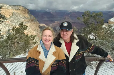
| Craig, was nice enough to shoot this for us |
Dee was accurate when we reached the south rim. Freshly fallen snow from the previous night had left really slick and icy walkways.
Wearing hiking boots, I knew there would be no slipping or sliding with this guy. Oh, how wrong one can be.
Walking from the train depot at the south rim, I felt like a poor try-out for an Olympic ice skating team. My left foot went right and my right foot went left.
“You okay?” Laureen asked.
“Dandy, just practicing some moves I saw on YouTube the other day.”
The sky was clear and blue. The weather, a bit chilly as we wandered the village with the ever present gorgeous view of the canyon to the east.
 |
| Weather was cold, but the views outstanding |
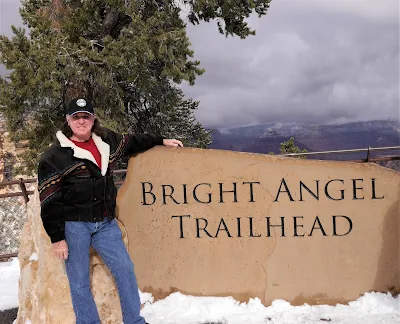
We did some short hikes and wanted to utilize the Bright Angel trail, but after seeing a few people fall and slide down the non-roped path, we decided to ‘just say no’.
“That guy nearly went airborne,” I stated, after seeing a woman grab onto a man, stopping him from flying into the canyon.
“He’s wearing flip-flops,” Laureen replied.
Wonder what chapter he’ll be in Ghiglieri’s next book?
 |
| Be careful on the trail during winter - it's mighty slippery |
The best time to visit the Grand Canyon? Anytime, is what I would say, but according to Bill, who works the train ticket office in Williams, “I’d say fall, less people and the changing of the colors are beautiful. Winter, the least traveled time due to the weather. Yeah, fall would be my choice. But, every season here is worth seeing.”
Bill could not have said it better, and it surely is a Grand Canyon.
 |
| Spend some time and visit the unique buildings on the rim |


