Pages

Thursday, February 8, 2024

Tragedy at Nelson Landing, Nevada

 “I remember coming here fishing as a young man in the early seventies,” the now older man said. “It was a wonderful location for families to camp, boat, and just have fun.”

Laureen, my lovely wife, and I had just met this fella along the shores of the Colorado River, not far south of the Hoover Dam.

South side of Hoover Dam

In all transparency, we were actually at Lake Mohave, but it is still all part of the Colorado River. In fact, gold ore used to be shipped along the river near the town of Nelson 350 miles to the Gulf of California. With the building of Hoover Dam, Davis Dam and others, the river was tamed and man-made lakes were created, but it is still all part of the Colorado River system.

We had been out exploring places we had not yet visited when we had found ourselves along the shore of crystal clear waters.

“Then in an instant it was all gone,” he concluded, and then drove off through the sandy wash westward.

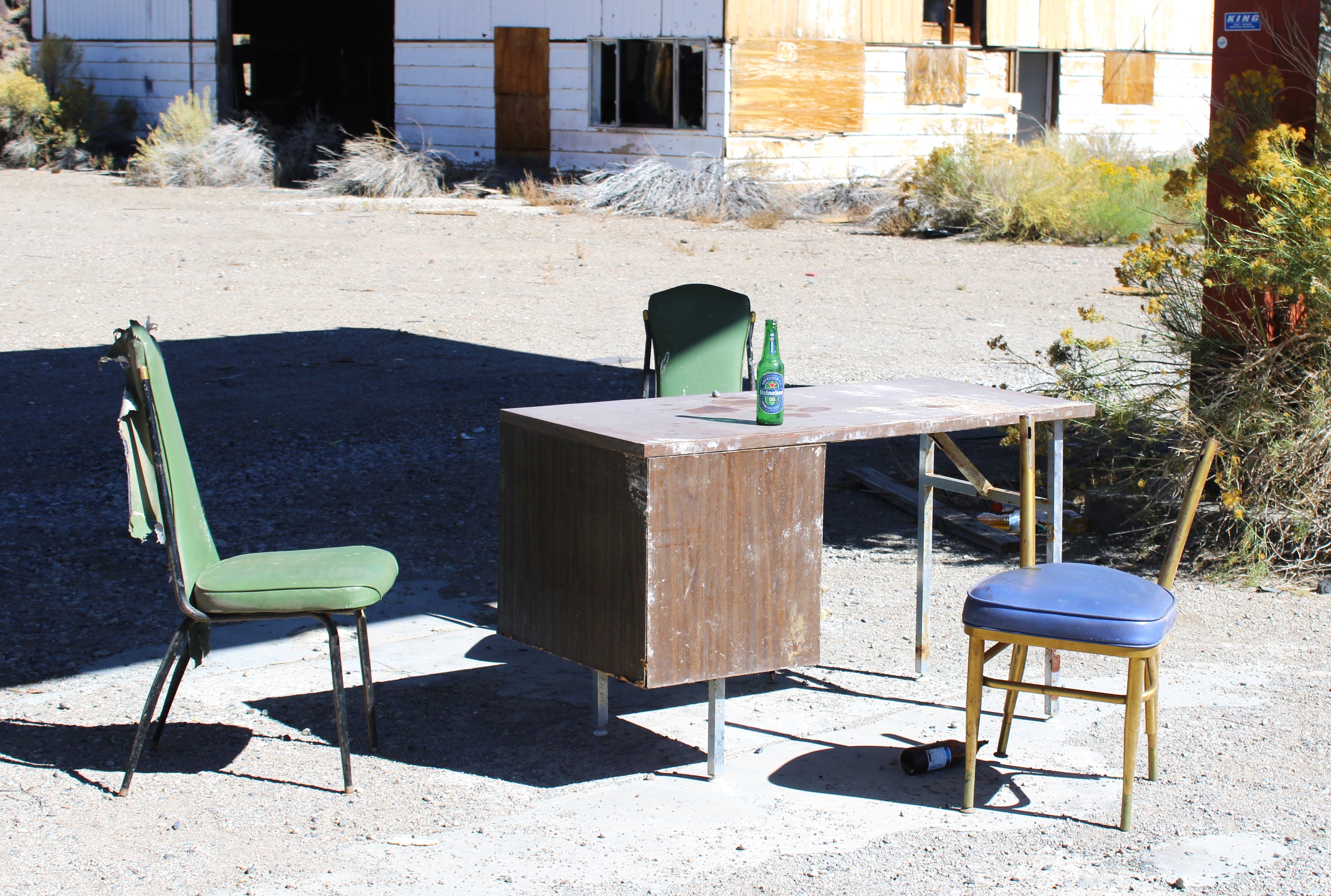
All that is left of the once popular Nelson Landing

A sobering moment as we learned we were standing on the ground where Nelson’s Landing had once stood. A river resort that had been loved and shared by countless folks for decades.

Nelson’s Landing had been located on the western edge of Lake Mohave in El Dorado Canyon, roughly five miles east of the ghost town of Nelson - which is where Laureen and I had actually been heading. But, unbeknownst to us - there was another story at the end of the pavement when we had decided to travel past the ghost town.

“Let’s see if we can get to the river on this road before touring Nelson,” Laureen had said, and being the dutiful husband and traveler agreed.

“All roads lead somewhere interesting,” I replied.

At that moment the idea of interest had been an understatement. Turned out to be a black ribbon of asphalt that had a tale of horror and tragedy at the end of it.

Nelson’s Landing had been a small beach settlement enjoyed by locals and visitors alike. Mobile homes, RVs, campsites, boat docks, restaurants, and other amenities made this place a must go river spot.

Original photo of what Nelson Landing looked like before the tragedy

Looking for a choice for water activities, there is Lake Mead, north of Hoover Dam or Lake Mohave, south of Hoover Dam. Take your pick. Either would be a good choice on a hot day. It was an easy destination for people living in nearby Boulder City or even Las Vegas, a mere 50 miles away. 

One such summer day was September 14th, 1974 where people were boating, laying on the sandy beach, camping, and enjoying lunch in one of the restaurants at the landing when the unexpected reared its ugly head.

Miles away to the west a storm cloud showed up and poured a monsoonal amount of rain onto the dry desert soil in only a few minutes.

The torrent splattered the desert floor, but with the sun scorched hardened earth the ground was like a piece of tile and that rain simply did what gravity intended - flow downhill undeterred.

Narrow canyon walls allowed torrents of water to flow

Soon a forty foot wave of water channeled from five separate smaller canyons rushed through El Dorado Canyon toward the resort. In a matter of minutes the resort was completely wiped out.

Among the rubble, only memories were left by those who had survived.

Nine people died on that fateful day.

Rescue workers looking for survivors at Nelson Landing

According to a July 9, 2019 online news article from 8@NewsNow.com (Las Vegas) - local resident, Tony Werly stated: “That’s fifty-two square miles that all merged into that one canyon. As the cloud was coming down the mountain, they (the people who had been enjoying the day at Nelson Landing) were trying to get their boat docks out of the water before they got rained on. They never knew what was coming down the canyon with it.”

Werly also stated a teacher he had once had, Jack Dailey, had been one of the victims of the flooding disaster.

“Dailey was actually a school teacher of mine when I was in high school and he was one of the guys that died.”

Dailey’s friend, John Gellifent, was also interviewed.

“Jack was out boating,” Gellifent said. “He was coming back when the wall of water hit.”

Turns out the teacher and friend of Gellifent’s had been out enjoying the river and upon returning to the beach in his boat he was overtaken by the destructive path of the flood and killed just offshore.

Nelson’s Landing was never rebuilt. There are now signs warning visitors that the chance of a severe flood is a real and present danger.

We looked out across the area where one minute visitors were having the time of their lives and the next, there was no time left.

“How horrible,” Laureen said. “To be here with your family enjoying a wonderful day and then that happens.”

I did not reply. My gaze took in the blue waters of the river in front of me and I could almost hear the terrified screams of those watching from wherever they were at the moment as a tsunami barreled down on them.

And then the frantic search and rescue through the rubble that had been a popular beach resort must have been heart wrenching.

It did not take a vivid imagination to feel what those poor folks felt as they looked westward up El Dorado Canyon and saw nothing but a huge debris filled wave of water racing toward them.

I felt chills run down my spine. To be standing at a gorgeous location, as this place is, and then to realize you are standing on hallowed ground.

People had perished here. Their only fault, just enjoying a hot summer day by cool waters.

It was not something we had expected to experience as we had happily been driving north along US Route 93 toward Boulder City, Nevada when we took a short jaunt toward the ghost town of Nelson.

A few years ago, my buddy Paul and I had powered up the Colorado River from Katherine Landing aboard my pontoon boat. It was a casual camping excursion, where we took in gorgeous inlets, water canyons, hidden coves, witnessed families of Bighorn sheep, and wild donkeys. The final destination of cruising by Willow Beach, on the Arizona shore to the Hoover Dam 12 miles to the northwest.

The blue waters of Lake Mohave

The previous day, we had witnessed dozens of people laughing while they jumped from some pretty high natural cliffs alongside the Colorado River on the Nevada Shore.

All through the warm months, people flock to Nelson’s Landing to jump off the cliffs into Lake Mohave. Some spots along the steep walls are 50 feet high and caution as well as a little dose of common sense are needed here.

I wondered if those summer loving folks realized that less than half a century ago, folks had literally fought for their lives on that sunny September day, and some had fought in vain.

“I boated past this spot without realizing the tragedy which had taken place,” I said to Laureen. “When Paul and I made our way to the Hoover Dam and saw people jumping into the water. Never thought of where or how tragic this place was.”

Laureen nodded.

Though the temperature was in the high thirties when we visited in January, the sun was shining making the water sparkle and the sand crunch beneath our feet.

No sign of a past calamity was to be witnessed in this picturesque setting. Just quiet and beautiful.

According to the National Weather Service - ‘Flash floods can roll boulders, tear out trees, destroy buildings and bridges, and scour out new channels. Rapidly rising water can reach heights of 30 feet or more. Furthermore, flash flood-producing rains can also trigger catastrophic mudslides. You will not always have a warning that these deadly, sudden floods are coming. Most flood deaths are due to FLASH FLOODS.’

The strength of rushing waters can dislodge huge section of earth

The fun-loving people enjoying a hot September day in 1974 did not think twice about a dark cloud far away on the horizon - why should they? But, in a matter of a blink of an eye rain fell in huge amounts and turned that care-free event into a horrific and unforgettable catastrophe. 

The teacher, Jack Dailey, did not live to see a school named after him in Las Vegas - Dailey Elementary School. 

Though I often make light of being out in nature and possibly ignoring signs about this or that - driving out of El Dorado Canyon on that January morning reminded me that signs are there for a reason and must be taken seriously.


Tuesday, January 23, 2024

Western Film Museum, Lone Pine

 Driving through Lone Pine along Highway 395, I decided to stop and have a looky-loo at the Museum of Western Film History.

I am sort of a geek when it comes to museums. I like them. I like them so much that I try to stop by most as I pass when on the road, which is a lot.

“There, a museum,” I may shout to Laureen, or the empty passenger seat while driving through this little berg or that little berg. “We should stop.”

Laureen usually agrees and when she is not traveling with me, the passenger seat remains silent, which I take as, “Sure, let’s see what is in there.”

That is the only sort of geek I happen to be. No techie here - nope. If the television is acting funny while I am alone at home, I will wait until someone arrives to save me.

“Dad, how long have you been sitting here staring at the screen?” one of my daughters may ask when they find me in the recliner with three days of beard growth.

“I can’t exit Netflix,” I may utter. “I’m in the twenty-fifth century with Picard.”

So, I decided to stop and check out this museum, which boasts it is similar to the Baseball Hall of Fame and Museum located in the small village of Cooperstown in New York State.

The similarity, which I read about on their website, means they are the one and only true Western Film History Museum tied to the special location of the village of Lone Pine.

Lone Pine is a lovely town, approximately 210 miles northeast of Los Angeles or 2,700 miles southwest of Cooperstown, New York.

The town of Lone Pine is worth a visit all in itself. Anyone who has traveled north along Highway 395 on their way to Mammoth to ski, to Reno to gamble, or to Tonopah for paranormal fun, knows Lone Pine.

The town of a little over 1,500 citizens sits at 3,700 feet above sea level on the southeastern slopes of the Sierra Nevadas in Inyo County. It is home to the Alabama Hills and entryway to Mount Whitney, the highest mountain in the contiguous United States, towering at over 14,500 feet.

Contiguous is just a fancy way of saying, among the forty-eight states in the continental United States. In the state of Alaska, also a part of the United States for those who are checking, sits either Mount McKinley or Denali (one and the same) which tops over 20,000 feet.

The town received its name from a once lonely pine tree that sat at the mouth of the Lone Pine Canyon. 

One item that pulls on the traveler's heartstrings is the monument dedicated to the folks who perished during the 1872 Owens Valley earthquake. At 2:30 in the morning on March 26th, a huge fault gave way and nearly wiped out the town which at the time contained a few hundred people. Twenty-seven residents perished and nearly 60 were seriously injured. It was later determined that the quake possibly measured anywhere from 7.4 to 7.9 on the Richter scale, which was one of the largest to ever strike California. It was similar to the monster that struck and destroyed most of San Francisco in 1906.

Each time I drive along that beautiful highway of 395 through the town of Lone Pine, I pull over and bow my head near the dedication monument for the victims who had gone to bed on March 25th of 1872 and never saw the sun rise again.

It is a very somber place to stand and reflect.

The museum is a historical journey of over 400 films and 100 television episodes that have been shot in the nearby Alabama Hills or other locales near Lone Pine or Owens Valley.

That is a lot of filming through the years starting with the 1920 blockbuster The Roundup, starring Roscoe ‘Fatty’ Arbuckle, Buster Keaton, and Chief Red Foxx.

The list from that beginning is long and interesting. 3 Godfathers in 1948, Around the World in 80 Days in 1956, The Great Race in 1965, Transformer: Revenge of the Fallen in 2009, Terminal Velocity in 1996, and my favorite Hopalong Cassidy and the Sasquatch Kid - release date unknown at this time.

While I wandered the exterior of the museum, a film crew was all set up in the rear parking lot. Long tables with food were beneath popup tents, loads of sound equipment stacked around huge trailers, make-up folks discussing which tint went with what tint, guys and gals walking around looking rather Hollywoodish, and a middle-aged guy in a suit having his hair dyed.

Getting ready for the next shoot at the Western Film Museum

I smiled and said hello to all I walked by. I was summarily ignored and decided to enter this western museum in Lone Pine.

Immediately I knew I should have stopped years earlier. The place is a cornucopia of film-making magic. Laureen, my lovely wife would have loved it. The empty passenger seat I had been currently traveling with could care less would be my guess.

One of the most intriguing exhibits is the 1928 RKO Studio camera car sitting like it just came out of the Ford production line. It is beautiful and all rigged out for a full camera crew to film any sort of moving action that was needed.

RKO Studio film car on display at the Western Film Museum

This vehicle has been used in multitudes of films including Steve McQueen’s movie, Bullitt, Bruce Willis and James Garner's film, Sunset, and Under the Rainbow starring Chevy Chase.

Meandering the multiple-room complex, which even has a movie theater, is a rewarding experience.

There is the history of Lone Pine mixed in with photographs, clothing, props, and anything else that will allow the visitor to fully understand the importance of filming has to do not only with this small town but the full cinematic industry.

An entire room is dedicated to the film series Iron Man, starring Tony Stark - I mean Robert Downey Jr. Easy to mix those two up.

Not far away in the Alabama Hills is where the Afghanistan ambush and escape took place and close by Olancha School was turned into a terrorist camp for the production.

Another exhibit is rather creepy, detailing the use of nearby locations to shoot the film series Tremors, starring Kevin Bacon. There are replicas of the Graboids, Shriekers for guests to view and get nauseous over, and a replica of the town the movie supposedly took place in Perfection, Nevada - a phony town.

Tremors creep-out on display at the Western Film Museum

It was perfect.

Of course, there are many items from earlier days of filming, such as a beautiful red Overland Stagecoach, supposedly used in the film, Rawhide. A dozen or more saddles hosted the rear ends of such legendary Western stars as Roy Rogers, Gene Autry, Cesar Romero, John Wayne, and many more.

There are prop guns, prop boots, prop jackets, and all sorts of other props that are and were used to make magic come alive on the silver screen.

Walking through the myriad of vintage film cameras including a Simplex, RCA, and Panavision, all surrounded by metal circular canisters to keep the secrets of the day's shoot hidden and dry is a delight.

Cameras for any film at the Western Film Museum

Photographs of legends are on every wall, as well as posters such as the one advertising Django, starring Jamie Foxx. One of the films, Gladiator, was autographed by the star Russell Crowe. Of course, John Wayne is lurking everywhere in life-sized cutouts depicting various Western films he starred in the Owens Valley.

The Lone Ranger

A red director’s chair used by Quentin Tarantino is dead center with a description of what film he used the chair for and a sign telling the guest not to sit in it.

Tarantino's chair on display at the Western Film Museum

I looked around the room - I was alone at the moment.

Dresses worn by leading ladies, like the sparkly fringed blue dress that draped one of the most famous female Western actresses of all times, Dale Evans are tastefully shown around the museum.

A room describing the building of an entire Indian town in the Alabama Hills is on display for the filming of the 1938 film, Gunga Din starring Cary Grant.

Being a car guy, one of my favorite sights was the 1938 Plymouth Deluxe coupe used in the 1941 film, High Sierra starring Humphrey Bogart. It is shiny gray which oozes class and seems to be in pristine condition.

A beauty on display at the Western Film Museum

A couple of hours or more is needed to see all that is to be seen at this museum. Every minute is worth it, if the traveler has an interest in filmmaking or simply to learn how Lone Pine is so important to this billion-dollar industry.

This may have been my first visit, but not my last.


Tuesday, January 9, 2024

A Pass through Montgomery Pass


Montgomery Pass to Tonopah along US 6

As I made my way through a myriad pile of junk - old rusted slot machines, broken down chairs, tables, shattered glassware, I suddenly felt as though I was being watched.

“You don’t belong here,” a voice seemed to utter. “You should leave.”

Taking a gander about this wreck of a once vibrant welcoming center, I decided to take that unknown recommendation to heart.

Once bustling visitor center and hotel at Montgomery Pass

Stepping up and over a windowsill without panes of glass, I knew there was something about this place, Montgomery Pass, that was inviting but at the same time unnerving.

I don’t believe in Casper flying about doing this and that, even though I do write about visiting supposed haunted places for columns each October. 

Thus, as I was passing this locale with dark overcast skies and threatening clouds, I was not looking for any paranormal mumbo-jumbo. I had just been passing by and discovered this empty soul of a small town.

Sitting at nearly 7,200 feet above sea level, it was chilly and uninviting, but at the same time, the place called out to be visited.

I was making my way toward the town of Bishop along US 395 via US 6 after leaving the town of Mina in Nevada along US 95. There were a lot of US highways on this route, one of the most patriotic road systems running through the area.

Montgomery Pass is near Montgomery Peak, which is one of the tallest peaks in California with its twin, Boundary Peak, not far away. Both peaks are over 13,000 feet above sea level. Those are some mighty tall peaks along the White Mountains, just east of the Sierra Nevadas.

Beautiful vistas behind the remnants of Montgomery Pass

According to the Nevada Travel Bureau, US 6 is the real Loneliest Road around. There are 297 miles of open roadway with only three towns with more than 100 people residing - Baker, in California, and Ely and Tonopah, Nevada. The truth is, you will not be seeing many vehicles along US 6.

I recall roughly two summers ago, traveling between Tonopah and somewhere when it suddenly dawned on me that I had not seen another vehicle for at least 30 minutes. A bit peckish, I stopped in the middle of the road, lit up the bbq and within an hour was enjoying a rack of lamb, sided with Za’atar roasted carrots and grilled asparagus, followed with a delicious glass of Fiji Water in a crystal goblet.

It is a lonely highway - as I was driving off after my scrumptious luncheon, I believe I heard the asphalt crying.

Montgomery Pass was a totally unexpected delight on this simple travel day. According to one of my favorite ancient Greek philosophers, Heraclitus: ‘If you do not expect the unexpected, you will not find it, for it is not to be reached by search or trail.’

Heraclitus thinking hard about something

And of course, this goes with my own belief which is to find sights you would not expect, you must choose the byways when traveling to see what may have not been seen.

A railroad was constructed over the pass between 1880 and 1883 using primarily Chinese laborers, who spent exhausting and dangerous time digging track lines, leveling off steep inclines, and blasting a 247-foot tunnel through a portion of Montgomery Pass.

In fact, the tunnel was the highest constructed, even outdoing the Southern Pacific Railroad tunnels near Donner Pass.

With the creation of an avenue from Nevada to California, mining also picked up in the early 20th Century with claims of various minerals being clawed out of the earth in the White Mountains and further east into Nevada near Tonopah.

One grizzled miner may have reported, “My claim is the biggest claim of any claim anyone else may be claiming.”

It is also rumored he spent quite a bit of time at the Liberty Club in Eli ruminating over glasses of rum.

The small enclave of Montgomery Pass began to grow during and after the construction of the railroad as a camp for the workers. Soon, not just goods and products crested the pass, but passenger trains also joined in allowing folks traveling from Reno to have a more direct route to the west into California.

Then in the 1930s, a decent road was established, allowing those adventurous folks in automobiles to travel across the high mountain pass and into the Owens Valley and beyond toward the Pacific Coast.

Railroad traffic slowed as mining dwindled and merchandise was easily transferred by commercial trucks, but that did not mean the end of the complex at Montgomery Pass.

Nope, since Nevada allowed legal games of chance and legal meetings with a certain kind of woman, the town became a mecca as a selective tourist stop.

Soon there was a hotel, bungalows, a large gas station, gaming rooms, bars, a restaurant, and supposedly a few bordellos - everything a traveler may need or want.

Abandoned motel at Montgomery Pass

According to the Reno Evening Gazette of June 24th, 1959, ‘although the gaming control board is looking sharply at a slot machine license application for the Mt. Montgomery Service Station bar and restaurant, owned by Nevada vice figure Joe Conforte, it probably won’t recommend a denial strictly on the ground there are shady ladies about. Actually, several Nevada bordellos operate slot machines and have done so for 20 years or more.’

A pastime of ours is to watch the warm and cozy family togetherness films in ‘The Godfather’ series on Thanksgiving.

So, in honor of Mario Puzo, I wonder if Joe Conforte offered the gaming control board an offer they could not refuse?

The somewhat bawdy history of the pass is quite interesting. In 1960, both Conforte and his bartender, Robert Paolo, were in court pleading not guilty to selling liquor at the pass without a permit. In the meantime, the liquor license issued to Mr. and Mrs. Joseph Campo was revoked, and not long after, Mrs. Campo decided to become a widow and murdered her husband, Joseph.

Dark deeds may have taken place at Montgomery Pass

Somewhere along the way, Conforte found himself in a lock-up in the Storey County jail and was offered $47,500 from a farmer out of Visalia, California for the property at the summit in 1960. The purchase was approved by the gaming control board given the provision that no prostitution or vice-guy Conforte would ever be near the property again.The farmer swore that would be the case, though in later years a bailiff may have mentioned that the farmer had his fingers crossed behind his back at the time.

In 1962, another sale for the property to the tune of $85,000, was denied by the Nevada Gaming Control Board on the grounds of the buyers utilizing questionable finances.

The businesses remained and thrived with tourists coming in from Nevada and California to enjoy the quietness and beauty of Montgomery Pass.

As I wandered the rather extensive grounds, I understood the draw.

Even deserted, there is a draw to Montgomery Pass

Rolling up out of the deserts of Nevada during the summer months must have been a wonderful reprieve from the often scorching heat. Bishop, only an hour's drive away, is often bustling and hustling with tourists year-round, so escaping up to the summit may have been a great place for a little solitude among the pines while dealing with a one-armed bandit.

In 1985, during an interview, a woman from Bishop mentioned why she loved visiting the summit. “I don’t like the big city casinos. I prefer this place because they get to know you, and always ask how you are. Plus the drive is marvelous and it’s a chance to get away from town for a while.”

The drive through the Montgomery Mountains is spectacular. Tall peaks covered in green trees and shrubs allow the driver to relax, hoping to see deer, elk, or a cryptid cross the road.

Tourists finally dried up for the businesses on the pass in the late 1990s, when gambling at numerous casinos operated by Native American tribes near Bishop and other areas along US 395 opened.

The gambling finally stopped in 2001. In 2010 many of the structures burned down, leaving Montgomery Pass just a reminder of a time when folks gambled on their future.

As I walked through the remnants of a burned-out building or two I could almost hear people laughing at a joke, screaming when they beat the house, and overall having a good time.

Empty chairs just waiting for the next unexpected traveler

Good times! The past and present when one ventures to the byways and finds the unexpected.

There you go, my man Heraclitus!